 |
|
 |
|
Manitoba: June 21-25
Tuesday, June
21
Bike log: 117.0 km, 305m of vertical,
avg speed 22.4 km/h
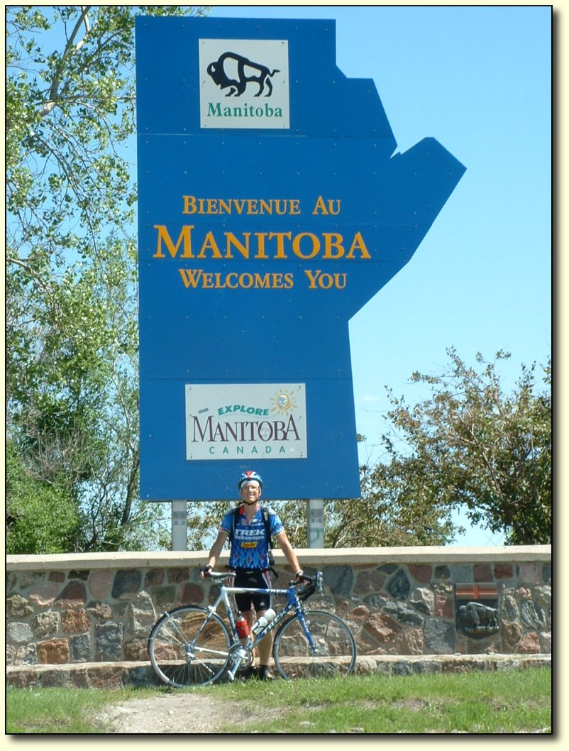
June 21 – Whitewood to Virden (MA)
Crossed another provincial boundary!
Compared to my expectations, getting through Saskatchewan took a lot
of effort. 6 days (including 1 rest day) to get through about 650km.
I guess it ended up OK, but 375 of the 650km were done in 2 days of
riding. It all depends on the wind (and thunderstorms). I was sure
not expecting to have days with such low distance in the prairies.
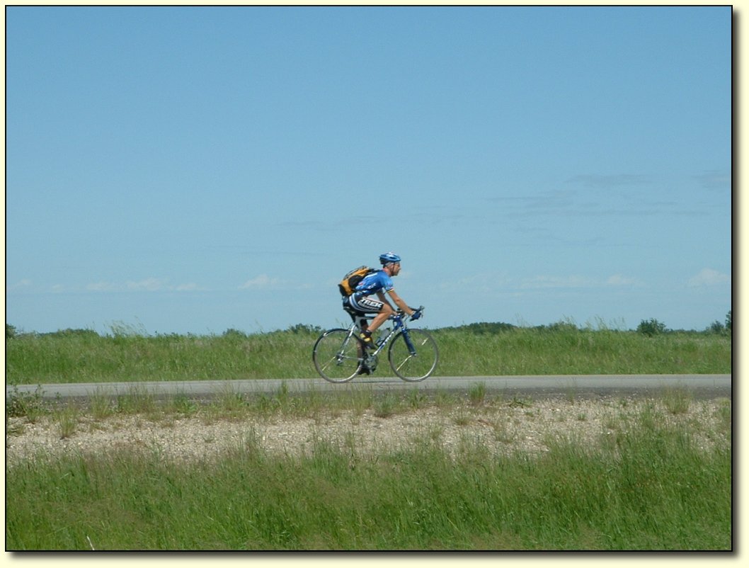
Riding into the
wind
Today was not a really long day in
terms of miles covered, and it was certainly not fun to be out in the
big wind, but it was one of the more rewarding days. I managed to get
a decent distance in without getting frustrated and questioning why I
was doing this trip! You just need to concentrate on riding well.
Small differences in efficiency, in both riding position and pedaling
stroke, translate into big differences in speed with so much
headwind. At times, my mind would drift off, and when I’d realize
it my speed would have dropped 10-20%. Probably a great training
exercise for normal conditions!
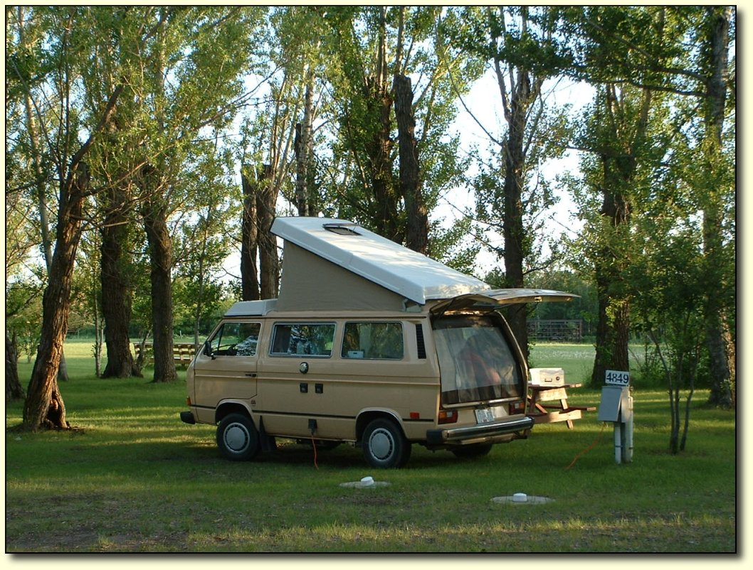
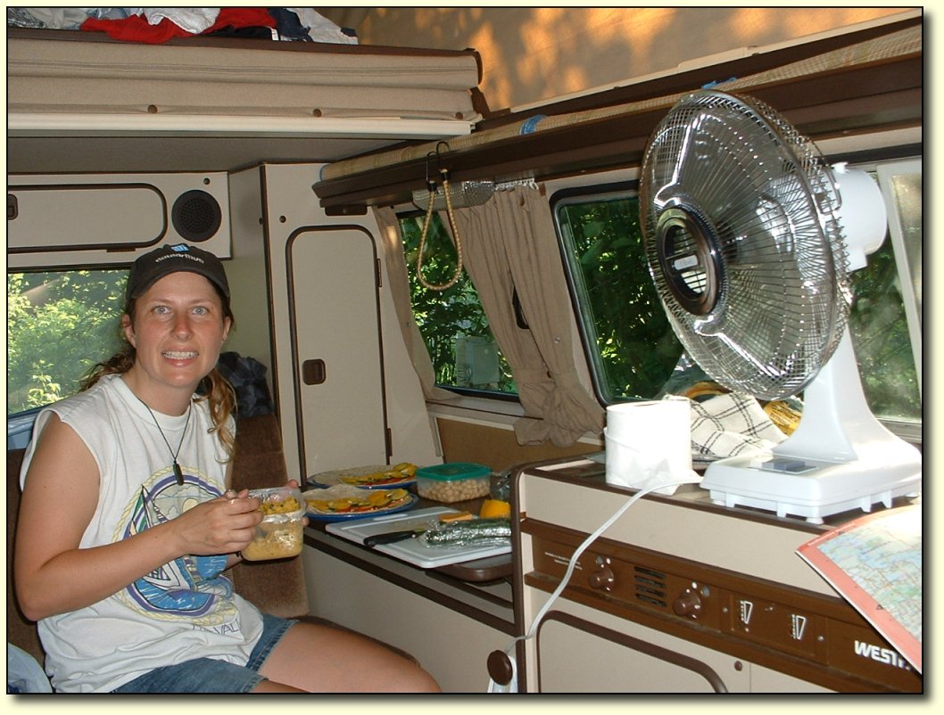
Poptop
Tonight we finally popped up the pop
top on the van. That should guarantee that we will get rain tonight.
(The top won’t leak, but it will have to be popped up and dried out
later - kind of a pain). It is hot in the campground and we are into
mosquito country now, so we can’t just leave the doors open.
Fortunately, the top has a nice big mesh window on it, and we have a
snap-in screen for the back. With both of those in place we get a
good breeze through. I am also going to have to buy a fan at the next
opportunity. Most of the campgrounds we’ve stayed in have an
electrical hookup which we pay for anyway.

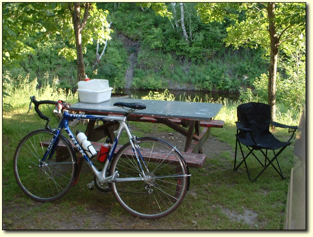
Sundown in Virden
The town of Virden where we are camping
is quite nice. All day, after we picked Virden as our
destination, the line, “I’ll never be, east of Virden”
kept running through my head. Guess what the tune for that one
was…hint: think Rolling Stones….

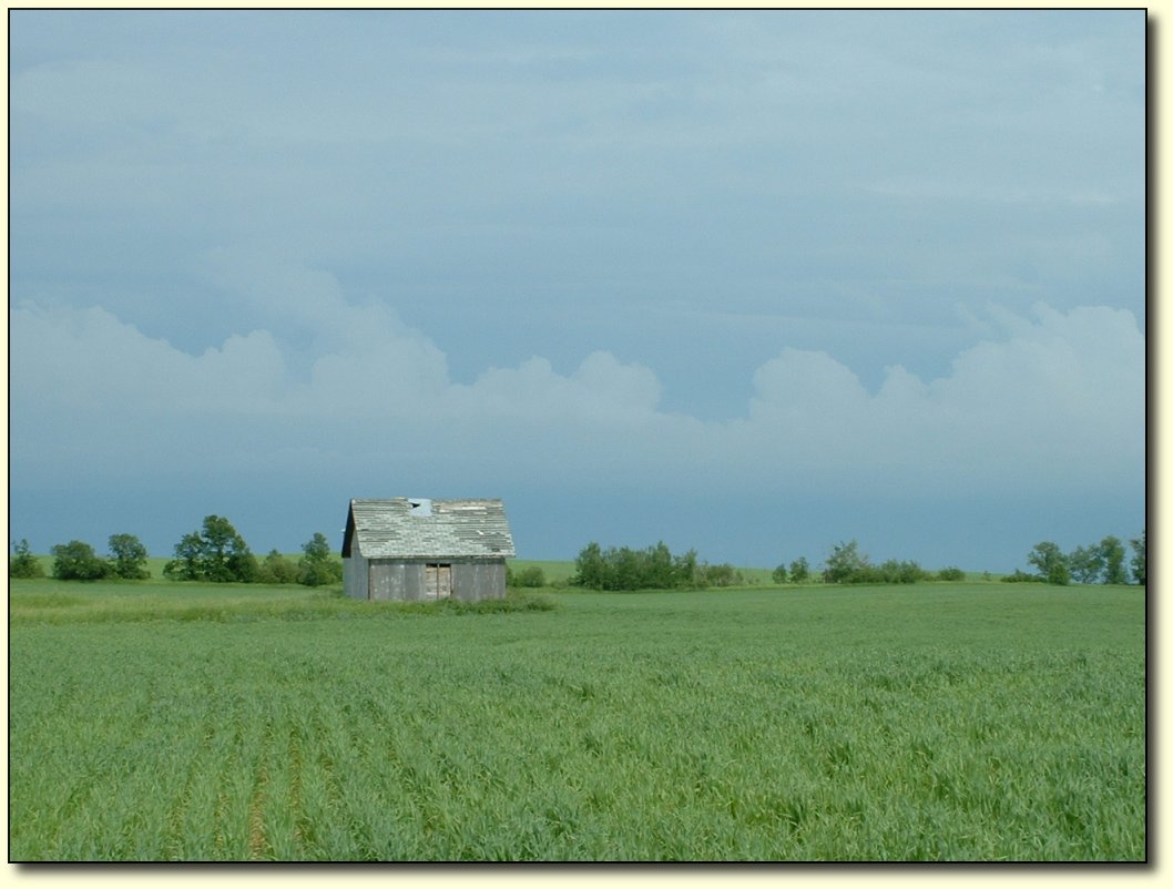
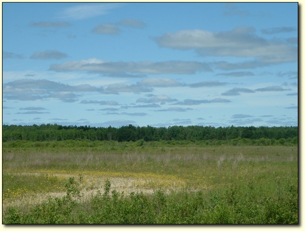
Grassy Walk
Cheryl took a walk after
dinner and got several great photos. This looks very peaceful,
although what you can't see is the millions of mosquitos that were
attacking her. A useful tip: don't be mislead by the absence of
misquitoes when you are walking into the wind...they will be with you
in full force when you turn around and head back!
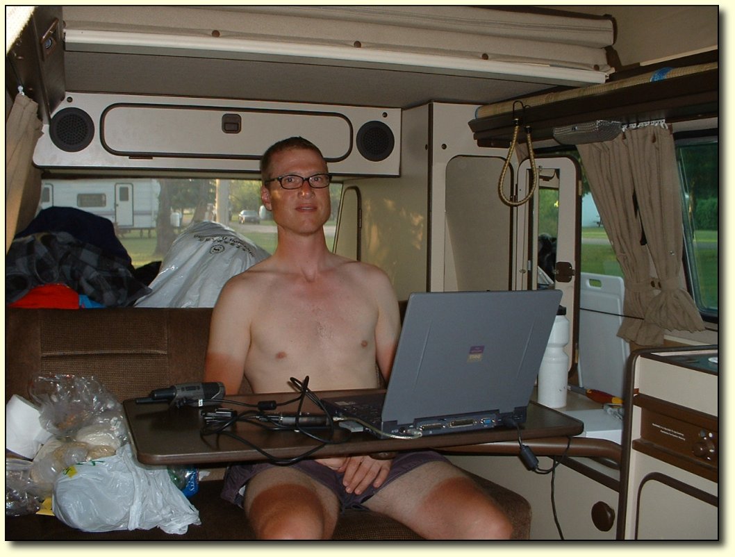
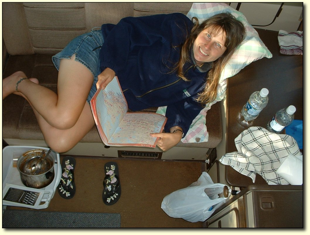
Office work
I
am usually too tired to go with Cheryl on her after dinner walks.
I do the dishes, then sit around in the van and drink water, eat
more food, and type up fodder for this blog.
|
|
 |
|
 |
|
|
|
|
|
|
|
|
Wednesday, June
22
Bike log: 89.6 km, 325m of vertical,
avg. speed 19.0 km/h
June 22 – Virden to Souris
A weird day, definitely one of the more
different ones! Immediately after leaving Virden this morning, the
nice paved shoulder that had been there since the border disappeared
and became dirt! Not gravel, like a gravel road, but loose packed
dirt! Maybe someone was thinking about putting in some potato plants
along the highway, I don’t know. Not very fun riding for a bike,
and probably not very safe for a car!
Fortunately, the shoulder on the other
side of the highway (Hwy 1 is a divided highway here) was paved and a
full lane wide , so I headed over there and rode along. Not too bad,
but it too turned to dirt after about 5 km.
I can ride on a gravel road no problem
(good tires) albeit a little slower than normal, and fortunately
there was a gravel service road running along the highway, so I rode
along there. That lasted another 5 km or so, and then ended at some
farmer’s house:
If you see this, go around
So I had to carry my bike through a swampy ditch to
get over to the highway, and then…rode in the grass alongside the
road! Where the grass gave out, I earned my dirt biking skills
bonus and powered through the loose dirt. Hard work but I didn't wipe
out!
The reason for ploughing ahead was to
get to the next town and head south to Highway 2 since the shoulder on Highway 1 has
turned unridable. So eventually after an hour or so of dirt/grass
biking we did get to a paved road that took us south. I guess I
haven’t mentioned the day's wind up til now – it was a blaster
from the south! First south wind on the prairies, I might add. So
after an hour or so of battling that (I won’t mention the rain
storm or hail that I rode through) we finally got to Highway 2.
Town of Souris
Heading east on Highway 2, we came to
the town of Souris by about 4 PM. We looked at the maps, and asked
some locals, but the next town along which had a campground was
Glenboro, another 70km, and so we decided to pack it in early. Just
as well since there were a number of things we have needed to do but
have not had time - laundry, wash the van, and buy a fan – all of
which we were able to do. Souris is a nice little town, right on the
Souris river. Kids were swimming in here, but the water looked a bit
brown to me! And the local hardware store was not quite sold out of
fans yet, although they had quite a run on them.
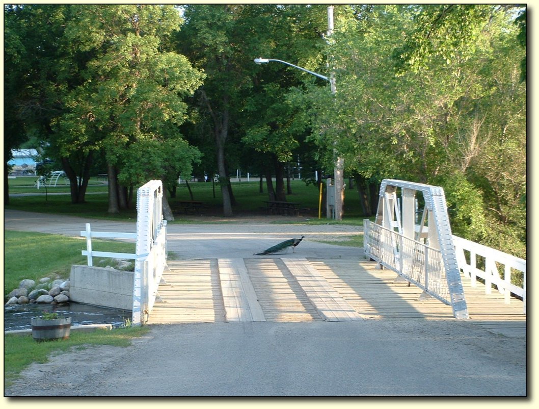
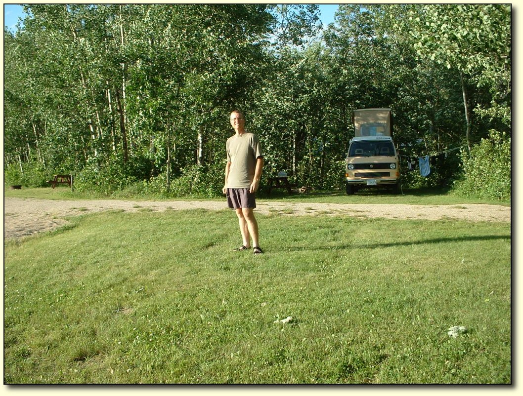
Peacocks in the campground
Another pretty campground here – in
the woods and beside a creek. Mosquito heaven! The campground is also
a bird sanctuary, and there are peacocks roaming around.
Air conditioning!
The fan is a great investment because
it is really hot and humid here today! We hadn’t washed the car
since we left home, so it was really overdue to get the bugs off the
front and a good cleanup inside. All in all, still productive even
though we didn’t get too far along today.
Cheryl invented pretty much the best
wrap ever! These were so good...I ate about 10 of them.
|
|
|
|
|
|
|
|
|
|
|
|
|
Thursday, June
23
Bike log: 169.6km, 396m of vertical,
avg. speed 29.8 km/h

June 23 – Souris to Stephenfield Provincial
Park
A long day, hard work for quite a bit
of it too! But it felt good to get some good miles in once again. It
was extremely flat for most of the day, but towards the end, as we
approached the park, we got into a few small rolling hills. Nothing
major, but it was kind of nice to have a reason to get up out of the
seat and work some different muscles for a change.
The wind could not decide what to do
today. Started as a headwind, then a crosswind, then a tailwind, back
to a headwind, and ended up with a tailwind! Overall I think it was
at my back more often than not, but shifting gears (literally as well
as mentally) to deal with the difference is a challenge. Just when
you think you are making really good time, you get slammed with a
headwind and your speed gets chopped by 30%! It was also raining on
and off through the day. However, it was far too hot to bother with
rain gear. The rain was a welcome relief.

Yellow fields
The scenery is very nice along these
secondary roads, as you would expect compared to the highway! We
weren't sure what this yellow flowered crop was (someone later told us it was Canola), but there sure was a
lot of it.
Very rural scenery
We got onto some very secondary roads
on the way into the provincial park. I am hoping to bypass Winnipeg
as much as possible, so we got off Highway 2 today (it also leads
into Winnipeg). Tomorrow we’ll either head a bit more south or I’ll
ride a bit of gravel road to get over the Red River. I suppose the
wind will decide which way we will go! It is surprisingly difficult to
avoid Winnipeg, all roads lead in there. I guess the bridges over the
Red River are few and far between.
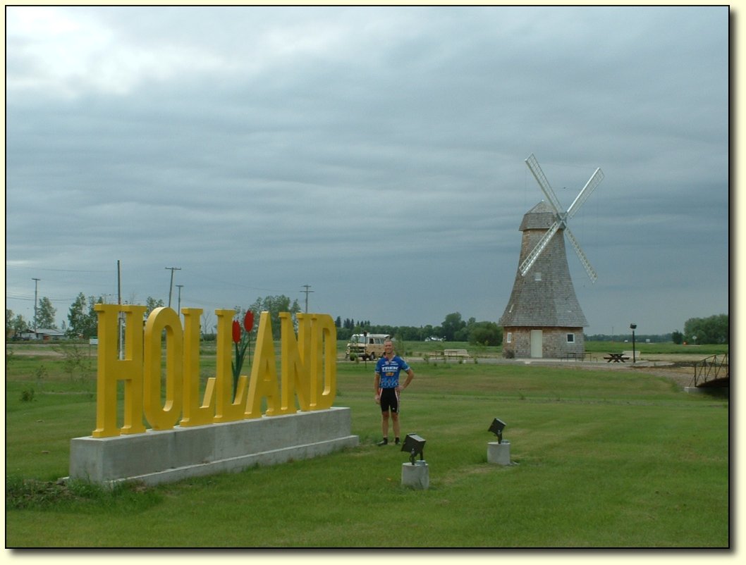
Made it to Holland
I knew we had been on the road for
quite some time, but I wasn’t expecting to get into Holland!
Having spent some time in Holland, I
can see why settlers named this area after it. It is incredibly flat!
And, of course, windy – hence the windmills. Unfortunately, "D.Q's
Lance Rental Service" next door was closed, or else I would have
taken a tilt at this one.
Stephenfield Park
This is the first provincial park we’ve
stayed in since leaving BC. None were in convenient places for us up
until here. It’s really well kept up, as are the parks in BC. It is
near a decent size lake, and people were out water skiing! The trees
are much shorter, and mostly hardwoods, and there are no mountains
but sitting in the campsite or wandering through the gravel roads of
the park I can imagine being in one of the parks back home. Funny,
even some of the small towns we’ve been in give that feeling – so
familiar.
It is strange to think how far we’ve come and how similar
things still are. I am really getting a sense of the size of Canada. In some ways, the trip has not
completely sunk in with me yet – I am really focused on the
day-to-day riding. When I look at a map and see the progress it
almost does not seem related to our trip. I have never spent very
much time at all in Alberta, Saskatchewan, or Manitoba, but I did
live in Ontario (southern and eastern) for about 17 years. As I
peddle into familiar ground perhaps it will help to tie things
together. For now, it’s probably just as well, since there is still
a long way to go. Thinking about such a huge amount of distance is
overwhelming, you’ve got to stay focused on making it through one
day at a time.
|
|
|
|
|
|
|
|
|
|
|
|
Friday, June 24
Bike log: 175.8km, 330m of vertical,
avg. speed 33.4 km/h
June 24 – Stephenfield to Richer
Had a really strong wind from the west
today – which was great for the most part! We took the south route
around Winnipeg and did not come within 40 km or so of the city.
Probably a good thing because the traffic was getting pretty bad on
the major highways that I crossed and it is not a particularly bike
friendly region. I did a few segments on gravel today, not too bad
but it is amazing how fast some people drive down those roads…and
don’t slow down for anything! Truckers seem to be the most
considerate, believe it or not.
This was the strongest wind in several
days. I am really glad it was from the west! But the dodging around
we did on backroads to get past Winnipeg did give me the opportunity
to head north, south, east, and west at different points. Going west
I was easily able to do 40-45 km/h, going east was about 15-20. North
and south were both around 25. Normally, without wind I average
around 30-32. I was not aware that a crosswind would affect the speed
that much, but I guess it makes sense – you spend a lot of energy
fighting to keep going straight, and there is only 1 source of that
energy!
Mosquito's eye view inside the van
Now that the warm (and hopefully dry)
weather is here we are popping the top most nights. We get a great
breeze through. It is pretty spacious with it up as well. This is a
view looking down from the upstairs, I am standing on the kitchen
counter taking a picture of Cheryl in the living room! It is nice
that it feels spacious in here since we are spending some time inside
it the last few days due to the mosquito situation. The wind tonight
is helping to keep them down, but man have they been bad! Once again
a reminder of how good we have it back home, definitely something I
have come to take for granted.
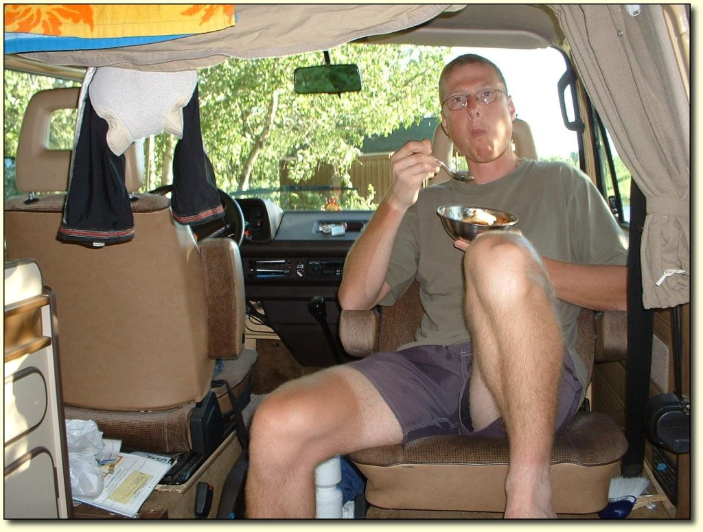
Chowing down
When I’m not on my bike or sleeping,
this is pretty much what I look like all the time. Nice tan eh! I
wonder how many years it will be before the line disappears. I am
getting a good handle on the eating situation though. I like to have
a small breakfast and get going as soon as we can, then ride for an
hour or two, and have a decent meal. I rest for a half hour or so
after that, (usually we stop in a town and pick up supplies or
something) and then hit the road. Unlike running or swimming, riding
after a large meal is not a problem as long as you aren’t doing a
huge hill or something, since your body is fairly stationary and
therefore the food doesn’t get all shook up. From then on, I try to
just do 5-10 minute stops every hour or so for a quick snack. Then a
big dinner at the end of the day, and more snacks into the evening!
Kind of funny, I’m not usually a big eater.
|
|
|
|
|
|
|
|
|
|
|
|
Saturday, June
25
Bike log: 154.6km, 597m of vertical,
avg. speed 29.5 km/h
June 25 – Richer to Kenora (ON)
Within about 10-20km of the border, we
started to get into some hills. Nothing huge, but the biggest ones
we’ve had since BC, and more or less continuously rolling. Very
much like the terrain around Victoria, but with smaller hills. I am
really enjoying the change and the opportunity to tackle the hills.
Riding on the straight windy flats requires a different mindset. You
just have to put your head down and go til the next rest stop, and
try not to think about anything related to progress! With hills and
curves, it is kind of the opposite – you are always watching what
is coming up, getting ready to gear up or down or stand up and
peddle. It challenges you in a different way, and I find it inspires
me to attack the hills.
I learned an interesting factoid. The
northernmost part of the US excluding Alaska is located on the shores
of Lake of the Woods! There is a weird bit of land that sticks up
above the 49th parallel for 20km or so, and is not attached through
land to the rest of the US! Kind of like Pt. Roberts near Vancouver,
but above the 49th parallel.
|
|
|
|
|
|