 |
|
 |
|
New Brunswick: July 27-30
Wednesday,
July 27
Bike
log: 160.1km, 809m of vertical, avg. speed 31.5 km/h
July
27 – Sayabec to Dalhousie (NB)
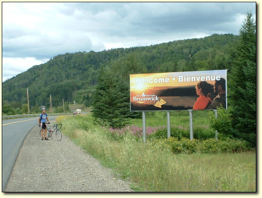
Here
we are in New Brunswick! We took a fairly sparsely traveled route
into the province, crossing by bridge just past Matapedia, Quebec,
and unlike every other border crossing so far, there was no “Welcome”
sign immediately visible. We checked our GPS maps, and looked across
the bridge to Quebec (which did have a Welcome sign up), and we were
pretty sure we were in New Brunswick, so we pressed on and eventually
found the welcome sign a mile or so down the road. I’m glad it was
there – it would have been a bad sign for the famed east coast
friendliness had we not been welcomed!
The
road through the Quebec side alternated between extremely good and
bone jarringly bad today, in about equal quantities. We hit some
construction for about 5km though, they are definitely working to
improve it. I found that the roads in Quebec were either terrible or
fantastic. I think they do not do a very good job of patching them
up, and wait until they are really bad before repaving. I have
definitely hit the worst potholes so far here. But the good parts on
the whole were much more common.
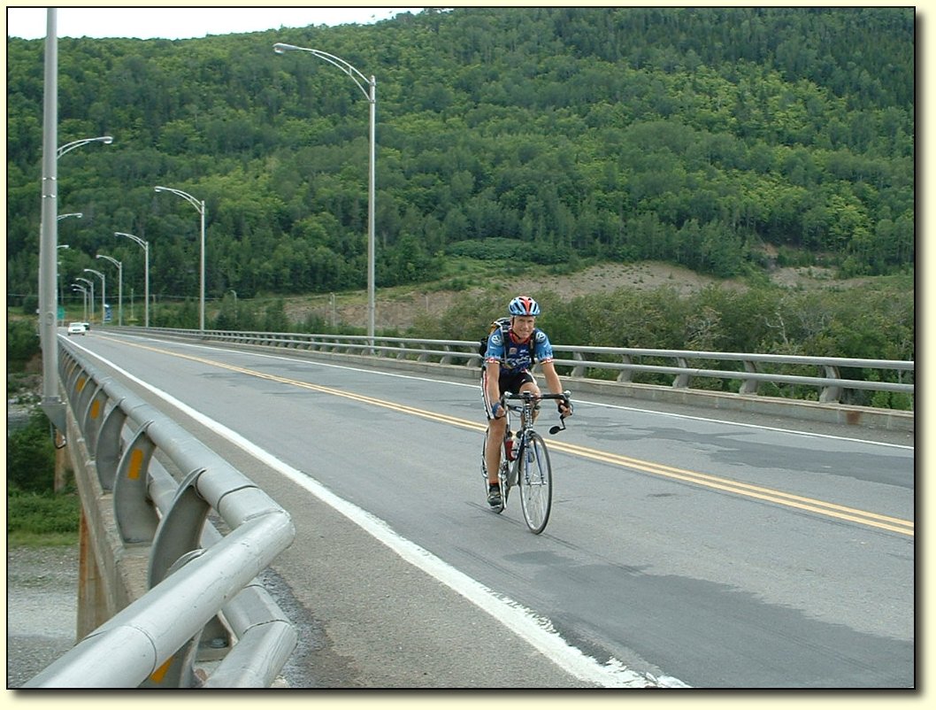
Confused
in New Brunswick
For
about the 1000th time, we were glad to have our Garmin GPS units. It
is really useful to be able to see not just a map, but where you are
on the map, and trust it! Sometimes the road signs do not jive with
maps, especially off the major highways.
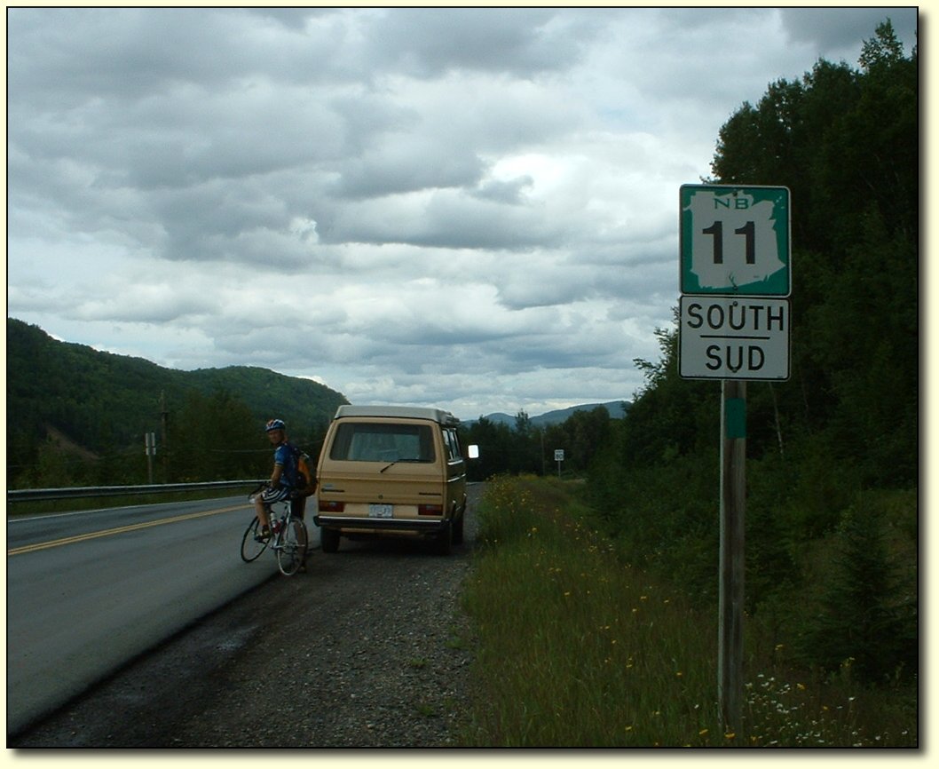
On
the New Brunswick side, the roads seem to be OK so far, although the
paved shoulder is not as common or well maintained. We are going to
be on secondary highways for the most part so I guess we’ll see how
it goes.
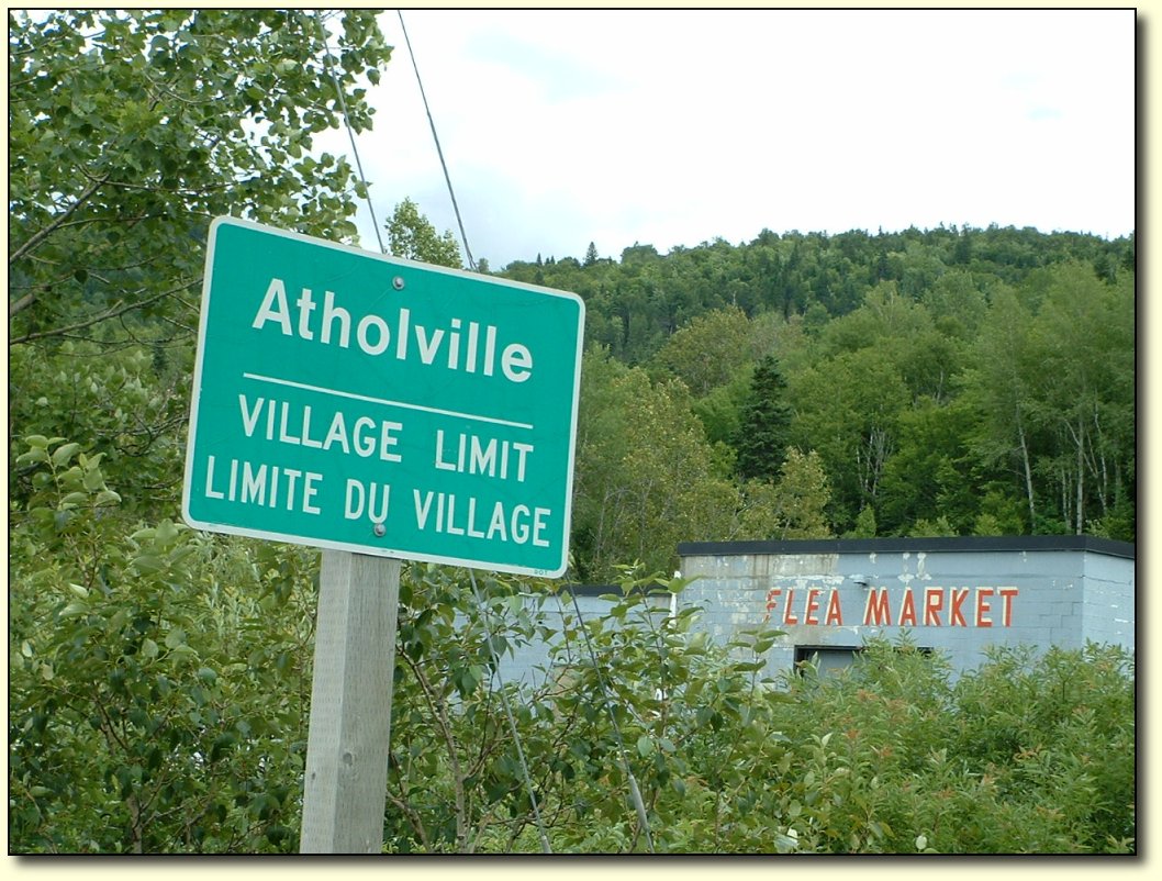
I got honked at here
I
am not sure if they have the same positive attitudes towards cyclists
here as they do in Quebec. Within about 10 minutes of getting into
the province I was honked at (as in, “get out of my way”) by
someone in Atholville. What do you call someone who lives there,
anyway? Probably something similar to what I called Mr. Honk.
My
rear view mirror finally exploded today – literally! I was riding
along, hit a little crack in the pavement and it busted into about 50
pieces and fell off my bike. I guess the potholes in Quebec were too
much for it! Just as well though, it was already worn out and
wouldn’t hold it’s position when you hit a medium size bump,
which was about every 2 seconds in many places!. Kind of a bummer
considering I just bought it in April, but then again I do have more
than 8000km on the bike since then (including my 2000km of training
in April and May).
Reminiscent
scenery!
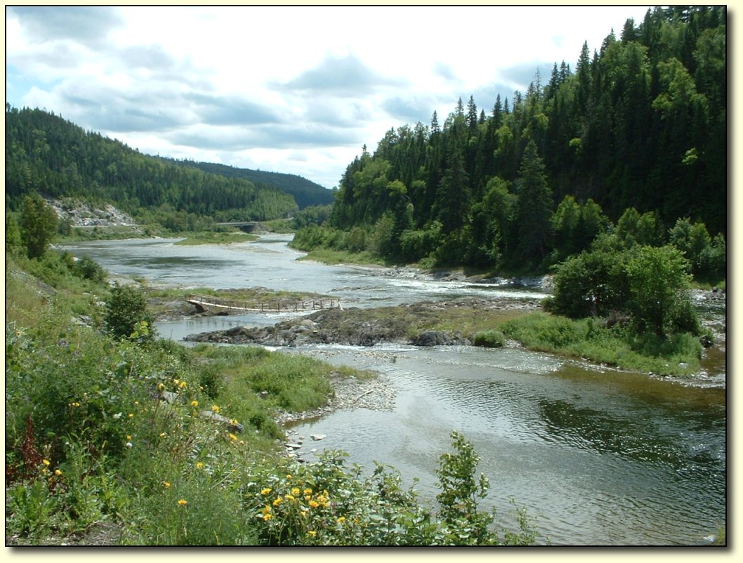
It
was a very scenic ride today. From our campsite in Sayabec, we
followed the Matapedia river all the way down into New Brunswick. It
was strangely reminiscent of the Similkameen river in BC, which we
traveled along many weeks ago (June 3rd and 4th). Yep, we’re still
in the same country as we started! This river is very popular for
fishing.
Crossing
into New Brunswick
There
was only 1 car on the bridge when I crossed into the province. Not
much traffic! From the Quebec side it did not even indicate that this
headed to New Brunswick. In fact, the road sign indicator pointing
towards Cambelltown, NB, which is the nearest city, actually urged
you to go further in Quebec before turning down! I guess they are
trying to keep people in the province for as long as possible.
Speaking
of which, being from out of town (to put it mildly) I always check
license plates, and in Quebec, even near the borders, almost all the
plates were from Quebec. Very few visitors. Over the border in New
Brunswick, there are many more out of province plates – lots of
Quebec, a few more Ontario, and some American. This area seems to be
quite bilingual – lots of french folks, but the signage is in
english and french. Perhaps this opens things up a bit more for
travelers. If you spoke no french at all, you might have a hard time
in some of the places we have just been through…depending on what
you wanted to do.
Packed
in
We’re
staying at the Dalhousie municipal campground (“Inch Arran Park”
is the name of it, not sure who are what Inch Arran is yet). Fairly
close quarters here as it is a full house tonight due to the
celebration of the town’s centennial anniversary. The spots on the
other side of the park are right on the water and look fantastic!
They’ve got the flags of all the provinces flying – I tried to
get the BC flag flying here but it was kind of flagging.
There’s
a free concert here in the park tonight. About 50m from our campsite,
as a matter of fact. They sound a bit like my dad’s band, “Just
Us” when they went through their country phase. The sound quality
is pretty bad, they could use a good sound engineer and some decent
speakers.
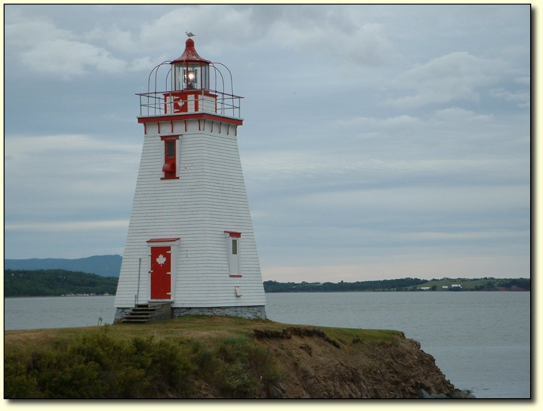
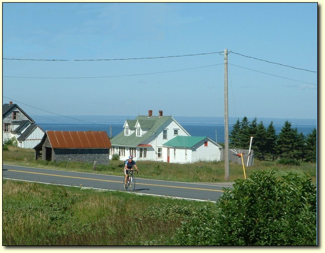
Dalhousie
Lighthouse
Today’s
ride cut across the Gaspe peninsula, and we continued in New
Brunswick onto the coast, overlooking Chaleur Bay on the Gulf of St.
Lawrence. There can be no further question of it – we are in
Atlantic Canada now. The towns have changed noticeably, as has the
scenery. The towns do not look as old – maybe because there are
more wooden buildings as opposed to the old stone ones in Quebec? And
the maritime feel is noticeable – lighthouses and open sea. Should
be some interesting stuff coming up!
|
|
 |
|
 |
|
|
|
|
|
|
|
Thursday,
July 28
Bike
log: 107.8km, 451m of vertical, avg. speed 31.2 km/h
July
28 – Dalhousie to Janeville
Didn’t
cover a huge distance today because we got off to a really late
start. The band played kind of late, and there were people milling
about until even later, and that combined with the hour we lost due
to crossing into the Atlantic time zone meant that we were not on the
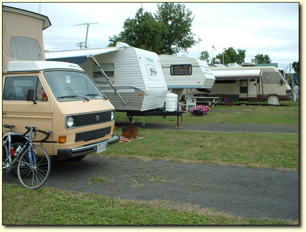
road until after noon! We are also a bit limited with camping options
(once again) due to sparseness of campsites. Or, at least, sparse
listings in the camping guide we have.
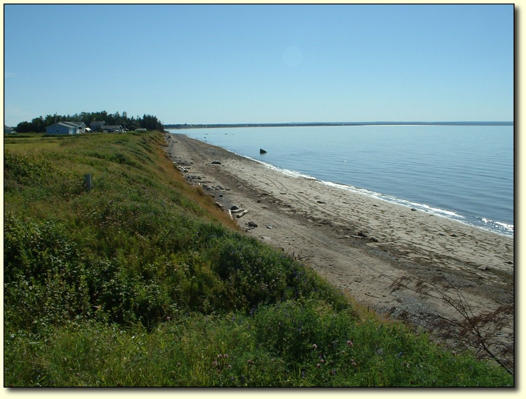
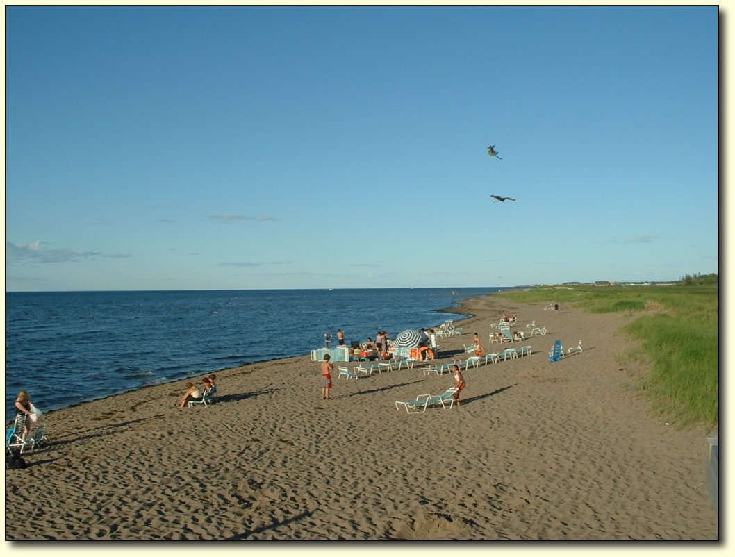
The beach in Janeville
The campground we are in
tonight is not listed in the official New Brunswick guide, it was
recommended to us by a local at the tourist centre in Bathurst. It is
one of the best (in terms of what I like in a campground anyway)
we’ve been in for a while – beautiful spot right on the water,
decent size lots, and nice and quiet. And cheaper than most as well!
I am not sure who puts together the official provincial camping
guides, or how they decide who gets in and what rating to assign, but
they sure use different criteria than I would!
As
planned we are staying off major highways and taking secondary ones
(highway 134 and 340). There is not much traffic along the roads
(with the exception of the area north of Bathurst) so it was a very
enjoyable ride. The pavement is not great, but better than many parts
have been. At least the patch jobs seem to help here, not like in
Quebec when it looks like they just randomly fling tar from the back
of a pickup using an oversized ice cream scoop!

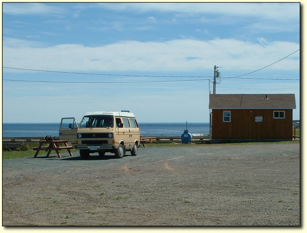
Home
on the water
We
are doing a minor scenic detour, keeping to the northern New
Brunswick coast for an extra 30km or so, and then cutting south. It
is really beautiful along this coast, and today was ideal weather to
see it in. Sunny and warm, but not too hot. It seems that most of the
waterfront area is populated, although in places sparsely so. There
are little (former?) fishing villages along the coast, and the houses
have that distinctive Atlantic look to them.
This
is Acadian country. As luck would have it, today is the 250th
anniversary of the deportment of the Acadians from what is now Nova
Scotia. Many of those people settled in this area and still remember
their heritage. It seems that this part of New Brunswick is very
bilingual, we are still hearing lots of french (and speaking a bit
too).
Rest
stop on the shore
We
stopped here for a picnic, it was right beside a little marina. I
have renamed this place “Unfavourable Wind Change Harbour” in
honour of the fact that I had a tailwind all the way here, but it
changed to a headwind from here on out. We also broke six eggs by
mistake. The sandwiches, however, were delicious.
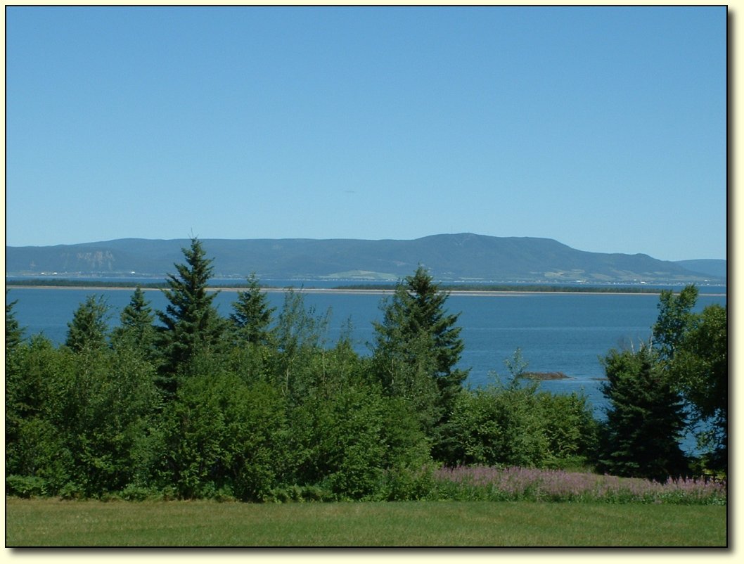
Quebec
across the water
I
am learning the geography of Atlantic Canada well. I never realized
that the coast of northern New Brunswick goes so far out into the
Gulf of St. Lawrence! All day today we were looking out across the
water towards the Gaspe peninsula. Tomorrow we’ll cut in a more
southerly direction.
|
|
|
|
|
|
|
|
|
|
|
|
|
Friday,
July 29
Bike
log: 149.8km, 500m of vertical, avg. speed 28.8km/h
July
29 – Janeville to Bartibog Bridge
Our
scenic detour along the north shore of New Brunswick was well worth
it, and I am glad we took it. The stretch of highway leading east
from Bathurst to Grande-Anse was definitely the most scenic part of
New Brunswick that we’ve seen so far. I am sure there are other
excellent parts to the province, but getting a road that is close to
it, with decent views, and is in decent shape with not too much
traffic is a tough combination! It was only about an hour of peddling
this morning, and then we headed south along the eastern coast.
From
there on, it was much less scenic – basically a straight, flat
highway through the woods. I had the weird sensation (I’ve had this
before) that I wasn’t getting anywhere because the scenery did not
change. The road was populated the whole way, and the towns were
quite small – more like the density of homes increased slightly
near the towns but the houses never stopped coming. It was also a
headwind the whole way, which never helps! But the road was in very
good shape, with a nice shoulder to ride on, and the weather was near
perfect. All in all, a tough day but still enjoyable.
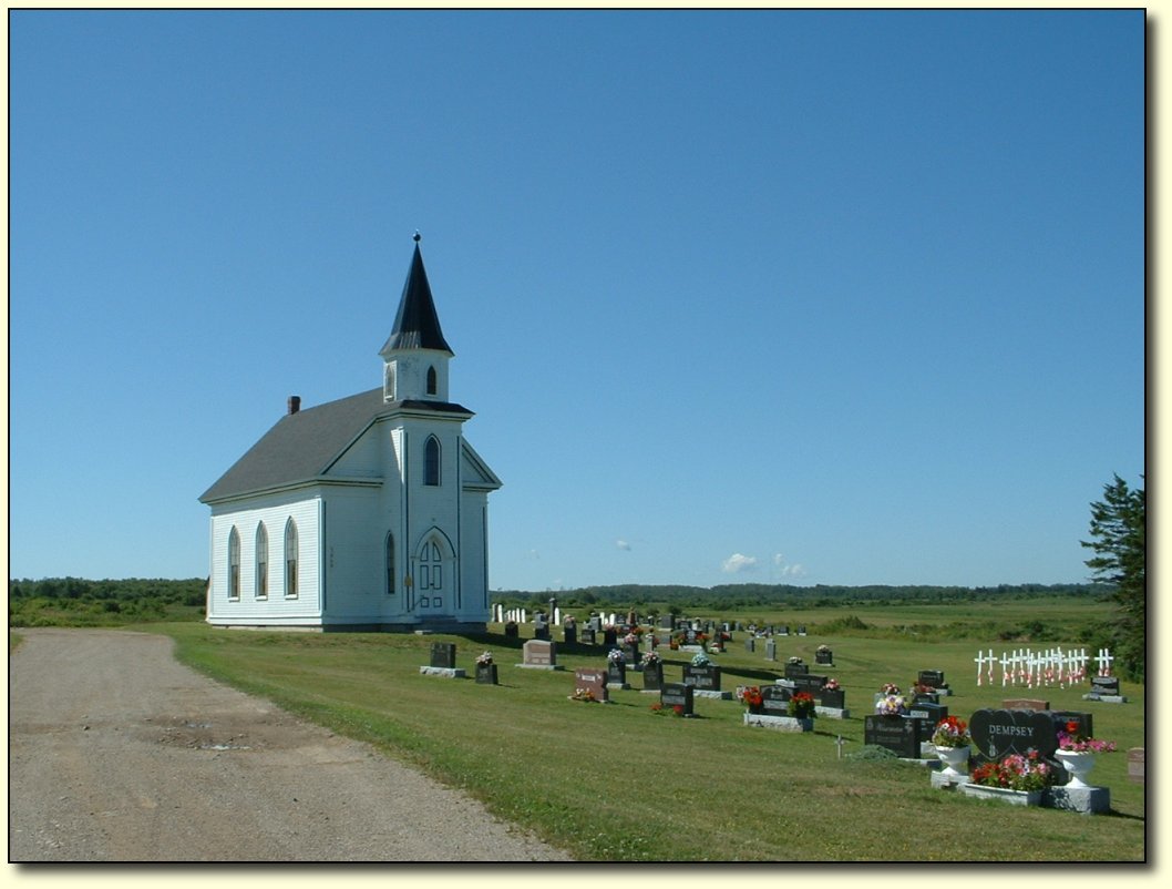
Churches
We
passed through a number of tiny towns this morning as we set out –
Clifton, New Bandon, Grande-Anse, Pokeshaw. It looked like there was
some farming around, but also some of these places were once (maybe
still?) fishing villages. I did not see too many fishing fleets but
the maritime feel was definitely there. Some of the towns did not
consist of much more than a general store, a few dozen homes
scattered about, and a church! Some of the churches were small and
cute…
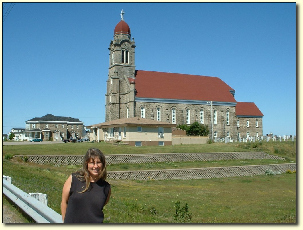
...while
others were massive and daunting!
I
guess some towns had more money for the construction of the church.
If you had a 100 years to do the trip we are taking, you would have
the time to find out the story behind every interesting thing you
see.
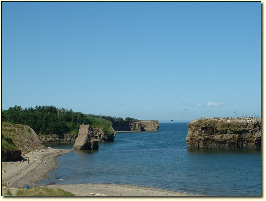
The
cliffs of Clifton
There
were some really interesting cliffs near Clifton, a well named town!
The seagulls liked them too.
I
have noticed the famous “maritime friendliness” as people here
are very chatty and friendly. Today as we were filling the van up
with gas we were chatting to the attendant, and he mentioned that he
had just been to Hope, Cheryl’s home town, last year. He was out
visiting some friends, who live in Hope had their summer home across
the street from where we were filling up! Cheryl did not immediately
recognize the name but no doubt the degree of separation is small as
the town is not big.
|
|
|
|
|
|
|
|
|
|
|
|
Saturday,
July 30
Bike
log: 165.0km, 616m of vertical, avg. speed 31.1km/h
July
30 –Bartibog Bridge to Cap Pele
A
good solid day’s effort today. We were on highways pretty much the
whole way, which meant there was not too much scenery (other than
trees and moose warning signs), but we did cover a lot of ground. The
traffic was not bad at all, being Saturday. Yesterday we were on a
secondary highway, but as I mentioned it was not particularly scenic
as it is not close enough to the ocean to afford views, and people
were speeding pretty bad on it anyway. So we figured today we would
just take the main highway (highway 11) the whole way, and all in all
it was fine.
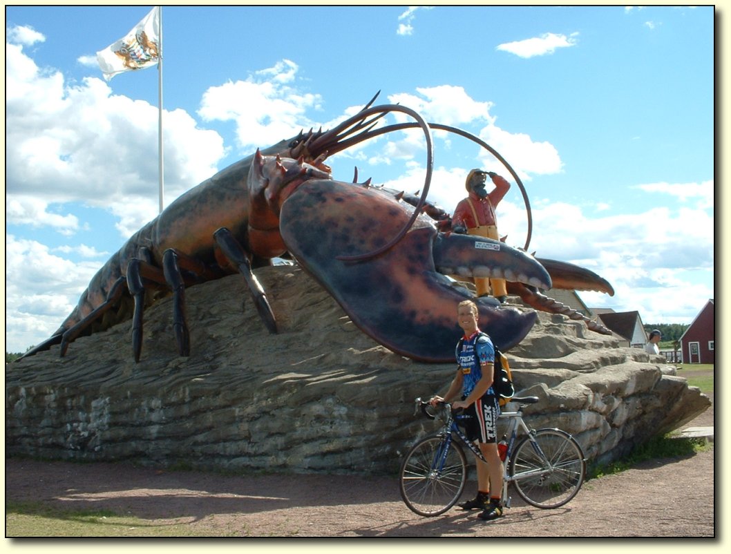
There
was a giant lobster in the “lobster capital of the world,”
Shediac. I couldn’t resist the photo, as no doubt millions before
me have as well.
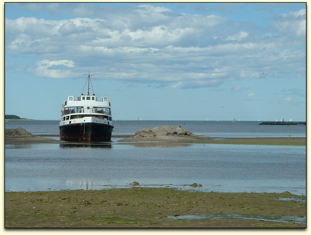
Boat near Shediac
The town of Shediac is very pretty, lots of waterfront as it is right on a bay.
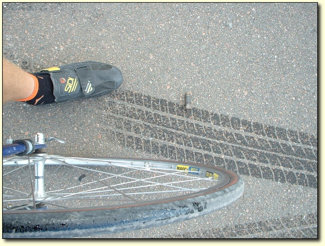
Number
100
Today
was a milestone of sorts. I passed my 100th wheel bolt lying on the
road. At least, it was the 100th since I started counting. Sometime a
while back (I think in Saskatchewan) I started counting these things
to help pass the time. I get a little bit of a thrill when I pass
one. Sometimes I can’t remember exactly what number I was on, but
I’m pretty sure this is number 100.
I
always wonder how the bolt got here. Did it fly off a moving vehicle?
Or did someone forget to put it back on after changing a flat tire?
Both seem unlikely, you’d think you’d notice either way. Or maybe
someone is driving down the road with a big bag of these, hurling
them at cyclists? A mystery for sure.

Gagnon
Beach Campground
I
wanted to get as close as possible to the bridge to PEI today, making
for an easy day tomorrow. The closer the better in case the weather
is bad in the morning! We were fortunate to get a tailwind for almost
the whole day, and it was a good thing too because we had to cover
more ground than expected. This is a very popular tourist
destination, and since it is a holiday long weekend most campgrounds
were completely full. We were planning on staying in Shediac (or
Parlee Beach Provincial Park) but all campgrounds there were full.
The people at the tourist information centre in Shediac mad several
calls for us and finally found us the last spot at a campground at
Gagnon beach. One of many campgrounds not listed in our guidebooks!
Anyway, it is in a fantastic location with a private beach on
Northumberland Straight.
Swimmable seawater!
The water is warm too – we went swimming
upon arrival! It is very shallow, and there are sandbars that you
could walk out to. It was still quite windy, and there were kids
flying these cool kites. Very festive place, much nicer than some of
the parking lot style campgrounds we passed by in Shediac.
Cross the confederation bridge onto Prince Edward Island
|
|
|
|
|
|