 |
|
 |
|
Nova Scotia: August 2-4
Tuesday,
August 2
Bike
log: 106.0km, 801m of vertical, avg. speed 28.4 km/h
August
2 – Charlottetown to Lower Barney’s River (Nova Scotia)
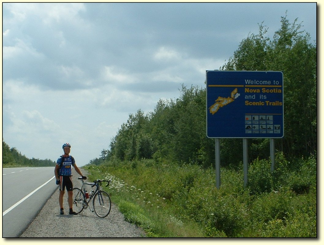
Made
it to Nova Scotia - they sure do have some great town names around
here! Very charming to read them off the map.
Today
we traveled about 52km to the ferry at Woods Island (PEI) and then
took the ferry (our 5th of 6) to Nova Scotia. On the PEI side, we
took a shortcut (highway 23) indicated on the map which turned out to
be really hilly! Probably saved a bit of time anyway, especially
since the trees gave some shelter from the headwind. There was almost
no traffic on the road as well.
The
hills were a good wakeup for me. I did not seem to have my normal
post rest day lag before getting going. I still don’t know what
causes that, but maybe a steep hill is all that’s really needed to
jumpstart things!
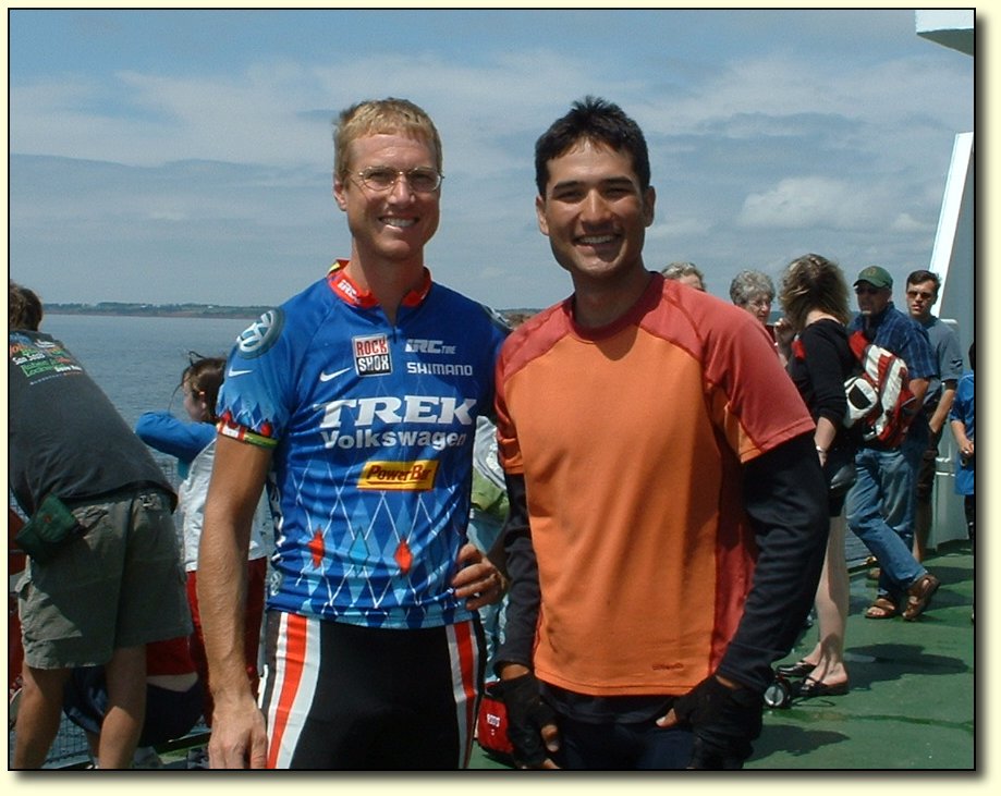
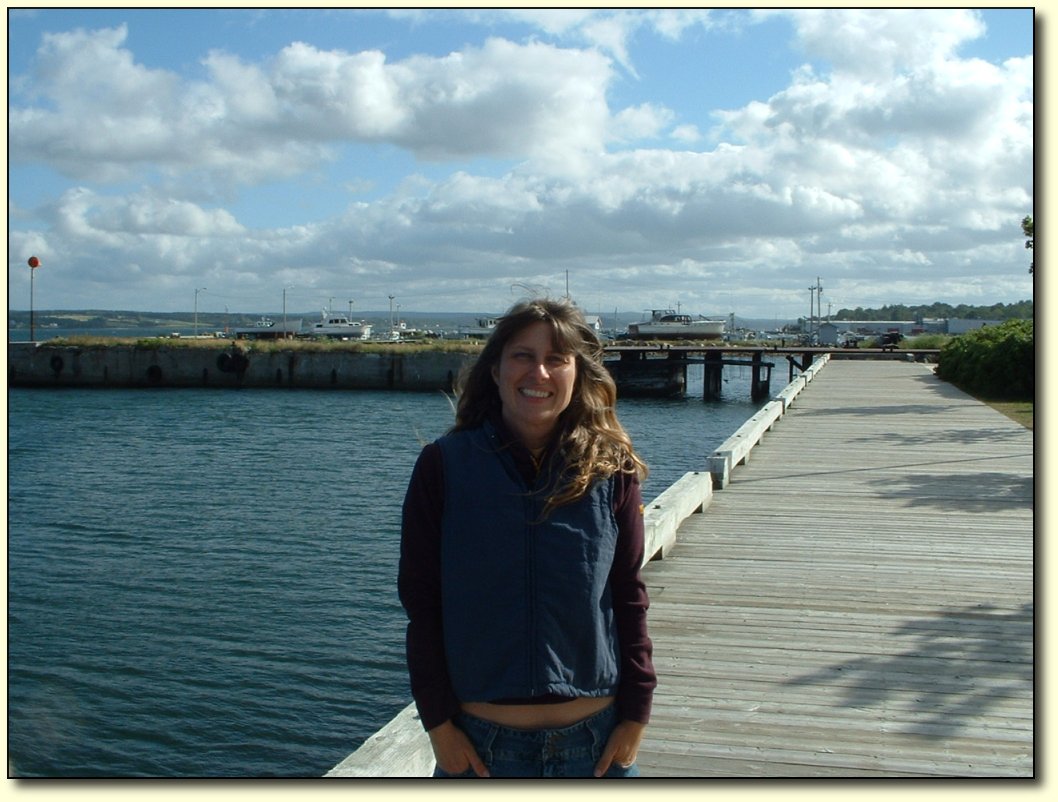
Reunion
with a fellow cyclist
Riding
time was a bit short today due to taking the ferry. We missed the 11
o’clock ferry by about 15 minutes, and had to wait until the 1,
which meant we didn’t get moving on the Nova Scotia side until
nearly 2:30. Still, it was a lucky occasion – I met up with another
cyclist (Ryan Dong) who I had met way back near Wawa. (Note: his trip is also blogged at www.xcanadabike.blogspot.com) We have traveled
similar routes, but with lots of differences, so it is quite
remarkable that we met up again, on the ferry of all places! Very
nice guy, and he’s planning on doing either the Cabot Trail, or
else the “long way” through Newfoundland before finishing up.
Both are tough rides considering he’s packing all his gear.

Us on the ferry
Ryan was able to get a rare photo of the two of us together. We are
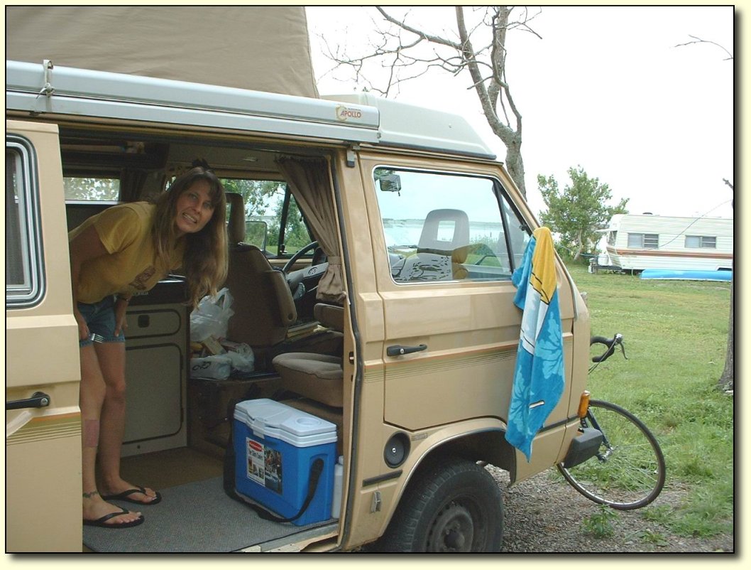
Dinnertime
in the van
Cheryl
is seen here madly cooking up a huge pot of pasta for dinner. I made
the mistake of underestimating the effort to get to the campground
today. We picked our route (trying to avoid the Trans Canada for a
bit), then looked for suitable campgrounds, and there really was only
1 option. It didn’t seem that far – just 55 km or so from the
ferry, so I went for it without a food break. I figured I had a good
rest on the ferry, and had eaten lunch prior to bordering, so I
should be good to go. But I bonked (ran out of energy) about 10 km
from the campground and so it was a bit of a struggle to get here. I
haven’t done that very often on this trip, probably twice. The last
time was when we took the ferry from Manitoulin – the big pause in
the middle of the day is tough to deal with! Live and learn though –
even the “short” days require careful food energy planning.
 \ \
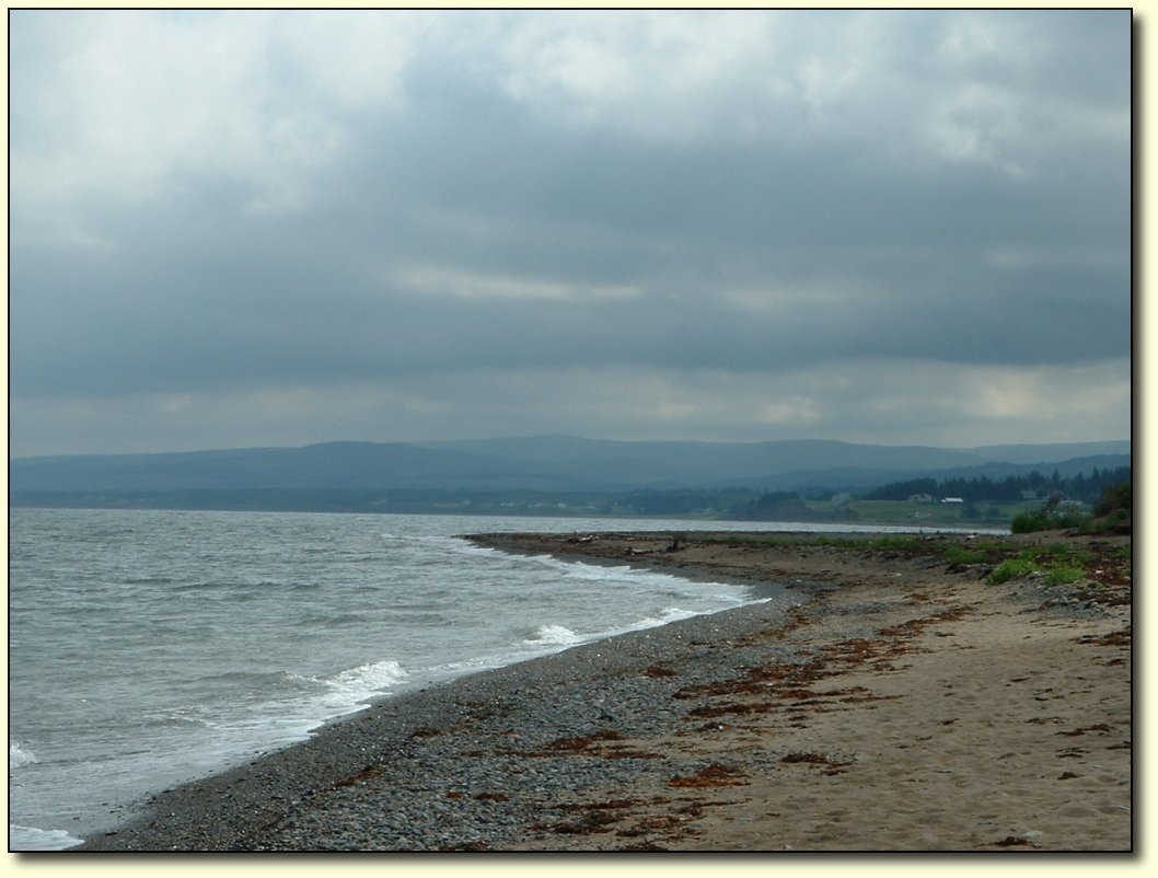
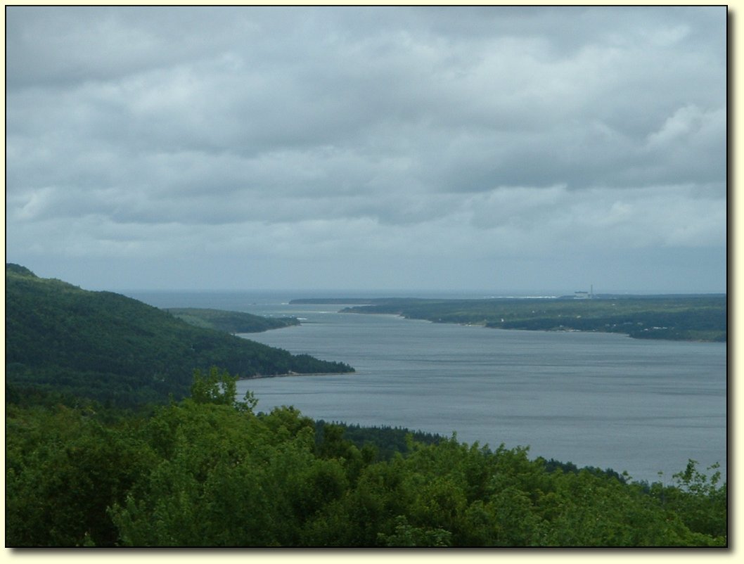
Nova
Scotia north shore view
So
far things have looked similar to the other maritime provinces. We
are taking a secondary highway (245) at the moment, which follows the
northern coastline of Nova Scotia, towards Cape Breton island, and
has given a few views of the water. We will follow this along to
about Antigonish, then I think we’ll be on the highway as we head
towards Cape Breton Island and on to North Sydney, where we catch the
ferry to Newfoundland.
I
find that as the trip is getting on, I have wanted to be off the main
highway more and more, and will even ride extra distance to avoid it!
The condition of some of the roads is a bit of a pain in the butt
though – literally!

Watching the sun go down
This
is a view from our campground. As I type this, the sun is setting
over the island and is a huge fiery red ball. Fantastic!
|
|
 |
|
 |
|
|
|
|
|
|
|
Wednesday,
August 3
Bike
log: 150.7km, 1087m of vertical, avg. speed 29.1 km/h
August
3 – Lower Barney’s River to Whycocomagh
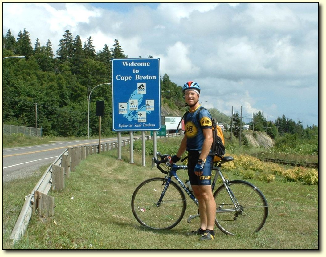
We
are in the home stretch now – onto Cape Breton Island. We are under
100km from the ferry to Newfoundland, so we should have no problem
getting there tomorrow (jinx!). I do not know what the ferry schedule
will be like. We have a tourism “brochure” put out by the Nova
Scotia government that is over 350 pages long. I haven’t gotten to
the part about the ferry schedule yet, it’s kind of difficult to
use…
I
was back on the Trans-Canada highway (104 and 105) for a lot of
today. I can’t say I missed it – there was lots of traffic,
although the condition of the road was mostly good. However, once we
got onto Cape Breton island this seemed to decrease quite a bit.
There are 2 roads that lead up to Sydney, one around each side of
Bras d’Or Lake essentially. Most of the traffic must take the south
road, because we took the north one and it is not too bad. Very hilly
though! In the 50km we took along there were 2 x100m climbs and 2 x
50m climbs, plus lots of smaller ups and downs. The other way may be
hilly too, all of the roads on Nova Scotia have been so far.
There
is a causeway that connects Cape Breton Island to the rest of Nova
Scotia. It was pretty hairy crossing as there was a really strong
crosswind coming through. I was grateful for (though puzzled by) a
big gap in the traffic going my way – no cars passed me in my
direction the whole way. Finally I got to the other side, where a cop
was actually stopping cars going the other way. I looked back and a
truck was moving a massive double wide mobile home that barely fit
across the road. Glad he was behind me!

Clouds
blowing in
It
got stormy today – lots of clouds for most of the day. However, it
did not really start raining in earnest until after we got to the
campground! It was quite cool as well, real maritime weather.
For
the first 50km or so today, we were on a secondary road (highway 245)
that gave us some really nice views of the water. Traffic was very
light along this road, which was good because the pavement was full
of potholes that I had to keep dodging. I am glad we took the scenic
route though. One local told us they refer to it as the “mini Cabot
Trail.” Kind of like a “Brussel Sprout Trail” I suppose, if you
pronounce it right. I am not planning on biking the Cabot Trail so I
am glad I at least got to see this part. It was by far the most
scenic part of the day!
Wind
and waves
The
wind got the waves going a little bit today. It’s cool to see waves
again – even little ones! Although it was not a nice summer day
today, in some ways it is better to see the sea with a bit of energy
and cloud. More exciting! Perhaps I will regret saying that if the
ferry to Newfoundland gets rough.
Although
it was a pretty strong headwind for about ¾ of the day, I was
glad to have the wind on several occasions. Today was probably the
worst I’ve gone through in terms of roadkill – I passed at least
a dozen really bad ones. What a reek! Maybe the Nova Scotia highways
department does not bother to clean them up, just leave it to the
crows, I don’t know. On this trip I have learned that a headwind is
much preferable for dealing with stink on the road – it minimizes
the amount of time you smell it and once you pass it you get fresh
air right away. My technique is to hold my breath as soon as I catch
wind of it, then try to hold it until I pass “the spot.” You
can’t do that if you have a tailwind because the odour follows you
down the highway for a long ways. I think if I’d had a tailwind
going past some of those flattened pelts I would have had a pretty
hard time keeping my peanut butter on the inside.
|
|
|
|
|
|
|
|
|
|
|
|
|
Thursday,
August 4
Bike
log: 99.9km, 860m of vertical, avg. speed 27.8 km/h
August
4 – Whycocomagh to North Sydney
Well,
this is about as far as you can go on the mainland! It is very
exciting to be here, we sure feel like we are getting close! We are
at the ferry terminal in North Sydney. We had a few hours to kill
before the ferry left, so we explored North Sydney. It’s a small
town, so it didn’t take long! However, it definitely had a maritime
feel to it – including a real working harbour. We are looking
forward to seeing a bit more of Nova Scotia, especially the coast, on
our drive back.
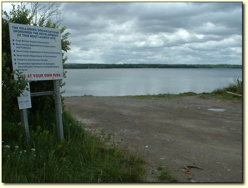
Boat Launch
Only
6 goverment organizations were involved in developing this awesome boat
launch. It looked pretty risky though, so we did not use it.
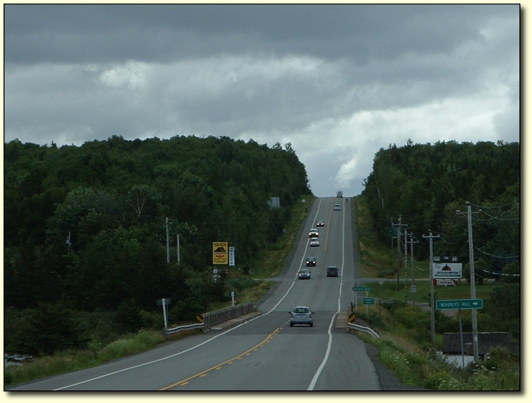
That's me on the hill
It
was a challenging ride today, even though the distance was not that
high, mostly due to a very strong headwind. The wind was nearly as
strong as some of those prairie blasters, but at least the road kept
changing direction a bit, and there was shelter due to hills and
forests. There were also some decent climbs as well as lots of little
up and downs like this one. The dot on the shoulder near the top
of the hill is me.
View
towards the Atlantic
The largest hill today was about
250m, and gave a really spectacular view once you passed the summit.
You could see for miles out to the Atlantic ocean, as well as down
towards the road ahead and a bridge that needed to be crossed. There
was a sharp switchback on the descent, after which the wind changed
to a tailwind for a short period. It was also quite a steep grade, so
I actually needed to use my brakes on the downhill! Normally I don’t
use the brakes as I find they just slow the bike down. But I was
doing close to 70km/h, and with the quality of the roads it did not
really seem too safe.
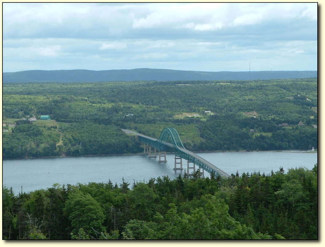
How
does the cyclist cross the bridge?
Answer:
in the van!
The
wind was an extremely powerful crosswind for the crossing of this
bridge. There was also no shoulder or sidewalk (pedestrians are
prohibited on the bridge), and the lanes were narrow – too narrow
for a truck to pass safely. So there was no safe option but to put
the bike in the van and drive across.
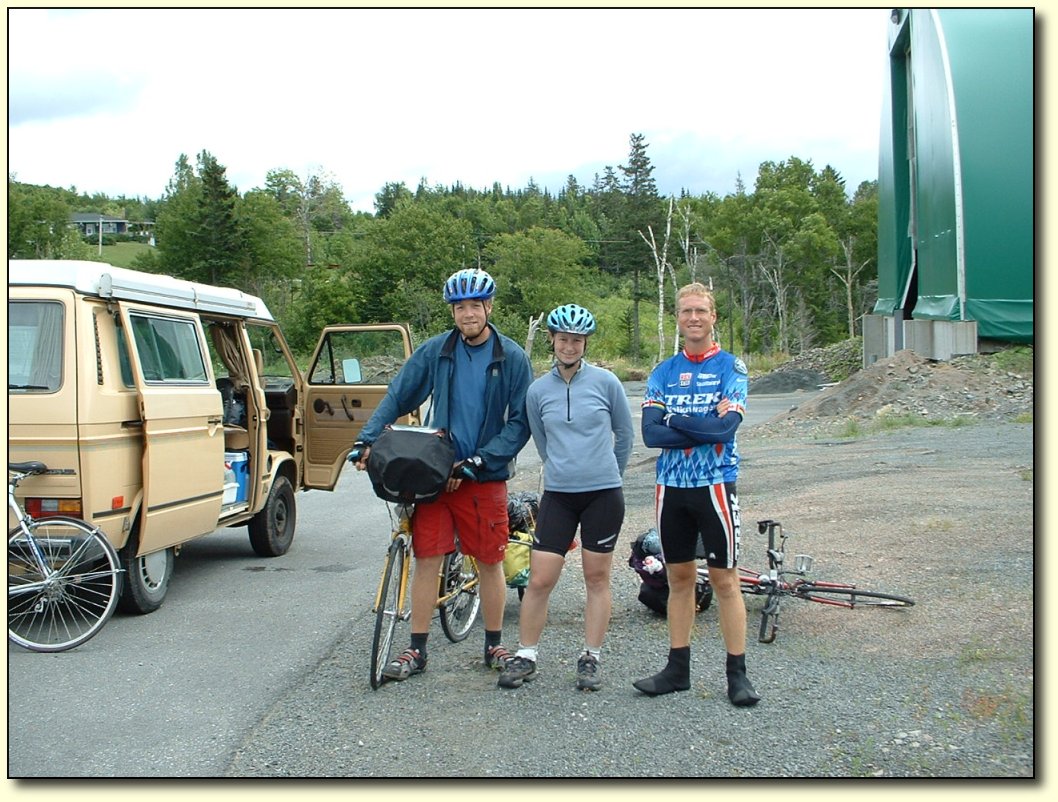
More cyclists crossing the bridge
Just
ahead of me at the bridge were 2 cyclists from Montreal, touring from
Montreal to Halifax (they had done the Cabot trail), who had started
across the bridge but turned back when the shoulder disappeared. They
had decided to try and hitchhike across, so Cheryl was able to ferry
all of us over the bridge in 2 trips! They were pretty grateful,
although I think I used up all that goodwill a little bit later.
Cheryl & I had lunch right after crossing while the couple
continued on. I passed them a while later & scared the beegeezus
out of them by accident – you really aren't expecting anything
silent to pass you when you are riding peacefully along. The gal
actually screamed as I passed…sorry! I’ve had a number of
cyclists tell me that I scared them that way, I’m not really sure
what to do about it as beeping my airhorn would obviously be much
worse and calling out is usually pretty hard to do with all the wind
noise.
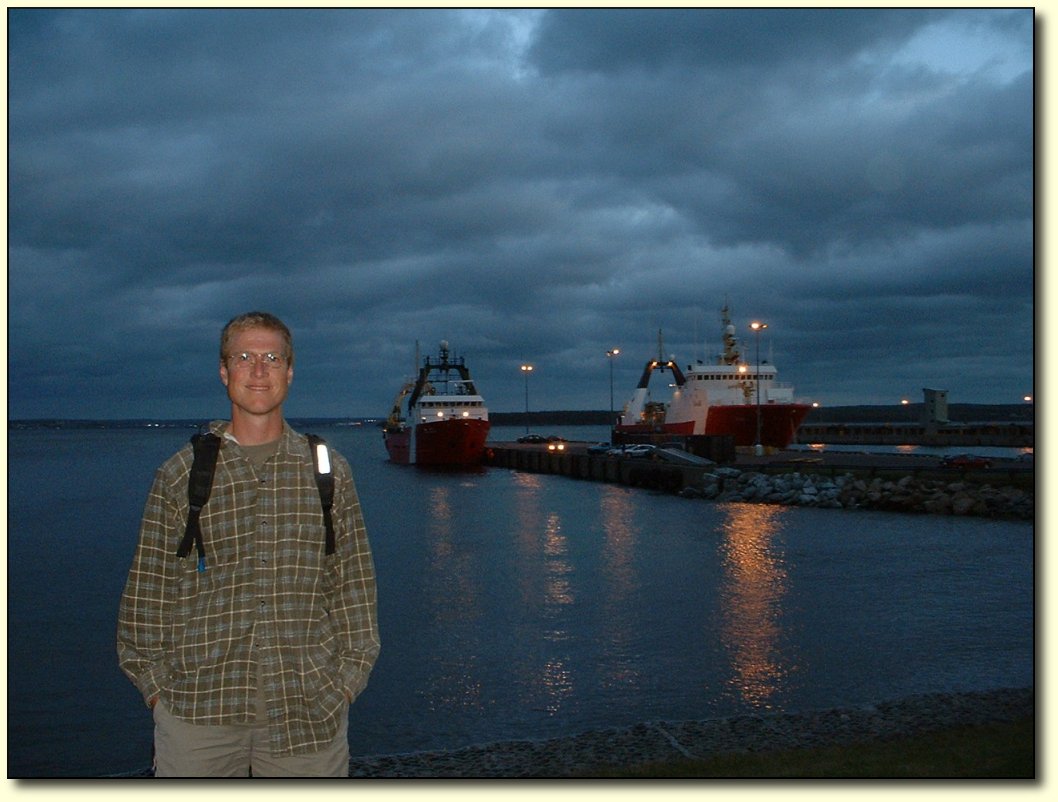
Icebreakers
and forgotten skills
These
coast guard icebreakers are needed in the winter time to keep the
ferries to Newfoundland moving, among other things. Apparently the
ferries occasionally get stuck in the ice and get delayed…for a day
or so. Just one more difference between the ferries here and back
home in BC. Speaking of which, I should also mention that the ferry
workers we met were once again very friendly. We chatted to the
security guard for a while, he had lived for 32 years in Nanaimo, and
sure missed the mild winters. Moved out here because he met a woman
from Newfoundland. Later on this evening, he was involved in an
altercation on the ferry – one of the disembarking passengers
forgot to take his medication and went berserk. Our friend took a
punch in the head, and the cops had to come and wrestle him to the
ground! He came back to tell us about it, proudly showing off his fat
lip. No worker’s compensation claim for him – and he was probably
nearly 70! Tough old guy.
I
have found on this trip that I have forgotten some things related to
my “old” day to day life. For instance, I have lost the ability
to button up my shirt properly. I now smile obliviously while my
shirt is all crooked - I can do this all day. It will probably be
some time before I regain that skill.
Ferry Across the Gulf of St. Lawrence to Newfoundland
|
|
|
|
|
|